Choose a street map or satellite view. With your screen locked in portrait and the phone held sideways, GPS orientation lets the stamp follow the scene or stay upright at the bottom of the frame.
See what to capture in the field and where the stamped file fits in your team’s reports, work orders, or site logs.
Construction
Show where work was completed
Give the next shift or project manager a site update they can place without a separate map.
Capture Photograph the finished slab and include a fixed landmark or section marker in the frame.
Check the stamp Use Satellite for the site overview. Check that the coordinates and capture time are visible.
Attach Add the stamped photo to the daily progress report or handover notes.
Illustrative field record
Slab pour complete
Location
19.112° N, 72.865° E
Captured
15 Nov 2026 · 08:42
Attach to
Daily progress report
Maintenance
Document a repair before and after
Help the service desk match the finished repair to the original fault, especially across larger facilities.
Capture Take a photo of the leak before repair and another after the replacement, with the equipment tag in view.
Check the stamp Review the location and time on both files before leaving the work area.
Attach Upload both photos to the existing maintenance ticket.
Illustrative field record
Pump seal replaced
Location
12.845° N, 77.663° E
Captured
15 Nov 2026 · 11:18
Attach to
Maintenance ticket
Logistics
Record a delivery handover
Give the dispatch desk a visual record of the delivery location and the shipment’s condition.
Capture Photograph the exterior of the shipment at drop-off and frame out customer details.
Check the stamp Use Map to show nearby roads and use the time stamp to record when the photo was taken.
Attach Send the photo to dispatch or attach it to the delivery record.
Illustrative field record
Pallet at receiving bay
Location
13.167° N, 80.249° E
Captured
15 Nov 2026 · 14:05
Attach to
Delivery record
Property
Keep inspection findings tied to the site
Keep survey photos from several visits easy to sort by location and time.
Capture Photograph the visible damage on arrival and take a second frame showing its position on the building.
Check the stamp Review the place details if available and keep both stamped images together.
Attach Add the images to the corresponding finding in the inspection report.
Illustrative field record
Exterior wall damage
Location
18.523° N, 73.848° E
Captured
15 Nov 2026 · 09:26
Attach to
Inspection report
Public works
Send a crew to the right location
Coordinates and a nearby landmark can help crews find an issue where street numbers are sparse.
Capture Photograph the blocked drain from a safe position and include a recognizable feature in the frame.
Check the stamp Use Map for road context and confirm the saved file has the coordinates.
Attach Include the photo in the service request so the crew has a location and a visual reference.
Illustrative field record
Roadside drain blocked
Location
17.455° N, 78.423° E
Captured
15 Nov 2026 · 16:32
Attach to
Service request
Agriculture
Revisit the same part of a field
Keep a visual record of changes across rounds even when the site lacks a street address.
Capture Take a wide photo of the affected irrigation row and include an identifiable boundary.
Check the stamp Use Satellite if imagery loads, or use the coordinates your phone can obtain when offline.
Attach Save the photo in the field log and refer to it on the next visit.
Illustrative field record
Irrigation line inspection
Location
11.094° N, 77.031° E
Captured
15 Nov 2026 · 07:53
Attach to
Field log
GPS photos across industries
Use the visible location and time to give each field photo context in the reports your team already uses.
Infrastructure & assets
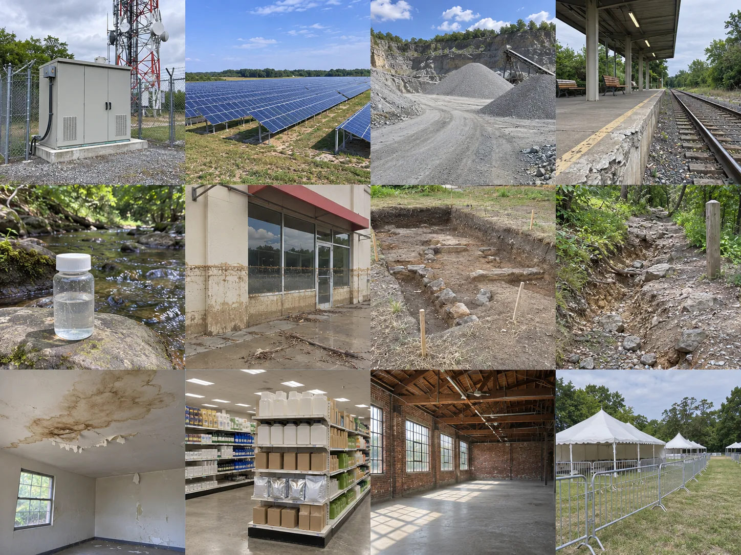
Telecommunications. Photograph a service cabinet with its site ID and attach it to the ticket for the next crew.
Renewable energy. Capture a damaged solar module and its row marker for the inspection record.
Quarry operations. Add dated stockpile and haul-road photos to the shift handover.
Rail infrastructure. Include the platform number in a photo of a damaged edge for the repair request.
Environment & recovery
Environmental monitoring. File a photo of the sample label and stream bank so colleagues can revisit the sampling point.
Flood recovery. Document flood marks from a safe location and add the photo to the recovery log.
Heritage conservation. Include a trench marker in a photo of an exposed feature for the site diary.
Parks and trails. Photograph erosion beside a trail sign so a maintenance crew can find the damaged stretch.
Site visits & operations
Insurance inspections. Include wide shots and close-ups of damage alongside the inspection notes.
Retail merchandising. Add a photo of a finished display to the visit report to compare setups across stores.
Film location scouting. Share wide shots and access points so the production team can shortlist sites.
Event operations. Include photos of gates and tent layouts in the handover so the next team can locate each zone.
Illustrative field scenes, ordered by scenario group.
Good to know
Does GPScribe work offline?
GPScribe can stamp the time and any GPS coordinates your phone can obtain without internet. Map images and address lookups may need a connection. The app can still save the details it has.
What location information is shared?
Map and address lookups can send location information to external providers to fetch the map or place details. When you share a stamped file, its visible location and time go with it.
Does the stamp change as I move during a video?
The video uses the location and time from the start of the recording throughout the clip.
Does the stamp stay visible when I share the file?
Yes. GPScribe writes the visible stamp into the photo or video itself so coworkers can read it in a gallery, a work order, or a report.
 GPScribe